Well after we left Rumbak and Hemis we decided to make some time by travelling in a car for a change and not walking. This meant two things, one we cover more places and second we stop losing weight. Yes the 5 days in Rumbak saw a 2 kg weight drop 😀 and don’t you think I am complaining. Anyways, one Gulzarbhai came with his Innova to pick us up from Zinchen where we waited for him for a while. Gulzarbhai was a Kashmiri who was living in Leh. Conversations with him were of the most interesting kind, we had a buddhist Ladakhi as a guide, a Kashmiri muslim as a driver and you just know you are in the state of Jammu & Kashmir and so you know where the conversation is headed! Some really wonderful things came through but that is for some other day. Today I will just share a few pictures from Zinchen to Khardungla via Leh, all pics taken whilst we reached the so called Worlds Highest Motorable Road Khardungla!
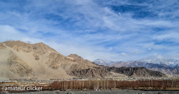
As we left Rumbak and started approaching Leh, the landscape was something like this. The Poplar trees indicate human habitation. Its only where humans live that there are trees, or else major part of the region is totally barren.

Some roads look a tad like you are in Kashmir!

That is the highway that connects Srinagar to Leh, we are about to enter Leh and I love the contrasts in this picture!

Leh is a dusty town, fast becoming touristy and a hub like Manali as more and more tourists alight here and make it a base for the activities to explore the Ladakh region. But amidst the chaos and wires and markets are also some views you don’t want to miss out on! 🙂

Then as we leave Leh and start climbing Khardungla here is an aerial shot of the town with Shanti Stupa high up ensuring peace in the little town!
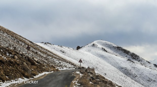
and then as we leave civilsation behind and head for higher, colder stiffer, difficult curves of Khardungla!

The tallest peak in this picture is Stok Kangri, we lived 5 days near its base in Rumbak. Looks a fair distance away doesn’t it?? We covered this distance in 5 hours of driving!!

One more of the same!

Then the winding road takes us higher and higher!

When the clouds make way for the stark blue sky it looks that much more pretty!

The first check point on the way to Nubra Valley via Khardungla is at South Pullu! where huge ice cubes had formed thanks to the extremely chilly winds that came from this direction! It was unbearably cold to stand out here!

I did say huge ice cubes right!? This huge as big as a brick!!!

As the road turns white read of snow its only the military convoys that cross us. During the peak tourist seasons they have traffic jams here. Thankfully we came in the peak of winter and there were no tourists! 😀

Just another turn, just another picture!

When the distance boards are not on the floor but have to be hung up higher as snow might just cover up the floor signs.

and then… finally…

the summit or pass… all passes in Ladakh are called La and hence this is a pass on Khardung mountain so Khardung la…

Khardungla is a gateway to enter the Nubra Valley and also the life line to Siachen posts, the worlds highest battle ground. Khardungla is kept working all year through so that the military has continuous access to resources.
More picture and stories from Nubra in further posts! For now its Julley! 🙂


